| Route | View | Download | Description | ||
|---|---|---|---|---|---|
| Google maps (with photos) |
Elevation profile |
GPX | KML | ||
| All tracks (simplified) on one map | gpx file | kml file | |||
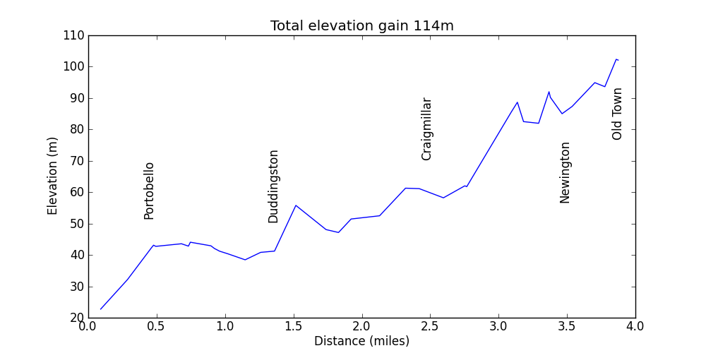
| Figgate Park to George Square | Profile | gpx file | kml file | for Martin | |
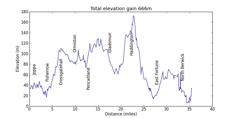
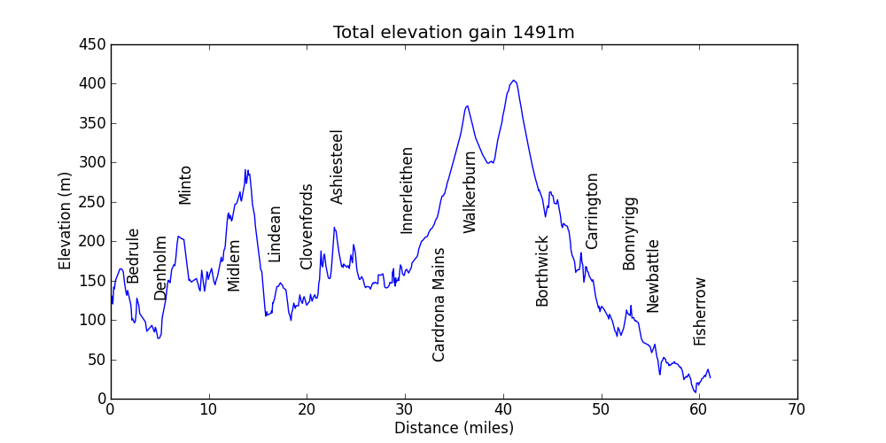
| Brunstane to North Berwick via Athelstanford | Profile | gpx file | kml file | probably around 35-40 miles | |
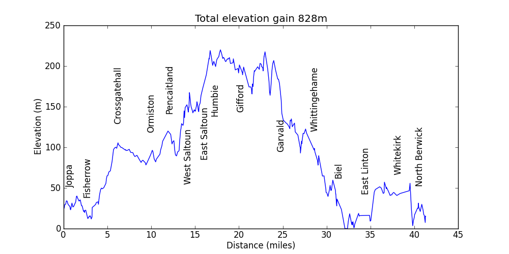
| Brunstane to North Berwick via Garvald | Profile | gpx file | kml file | 45 miles | |
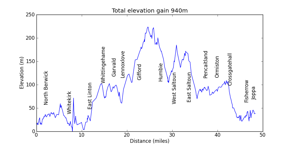
| North Berwick to Brunstane - southern meander via Gifford | Profile | gpx file | kml file | 55 miles including backtracking due to a missing viaduct | |
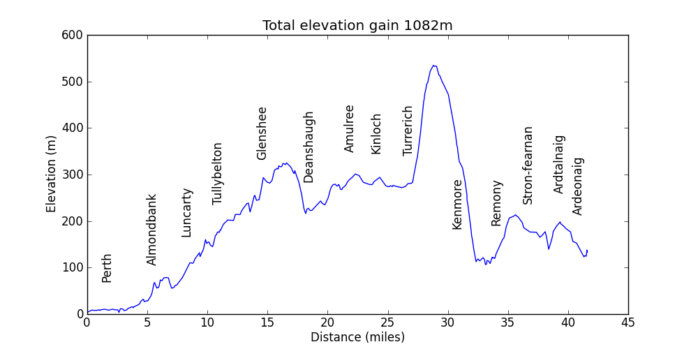
| Perth to Loch Tay | Profile | gpx file | kml file | 43 miles across the tops | |
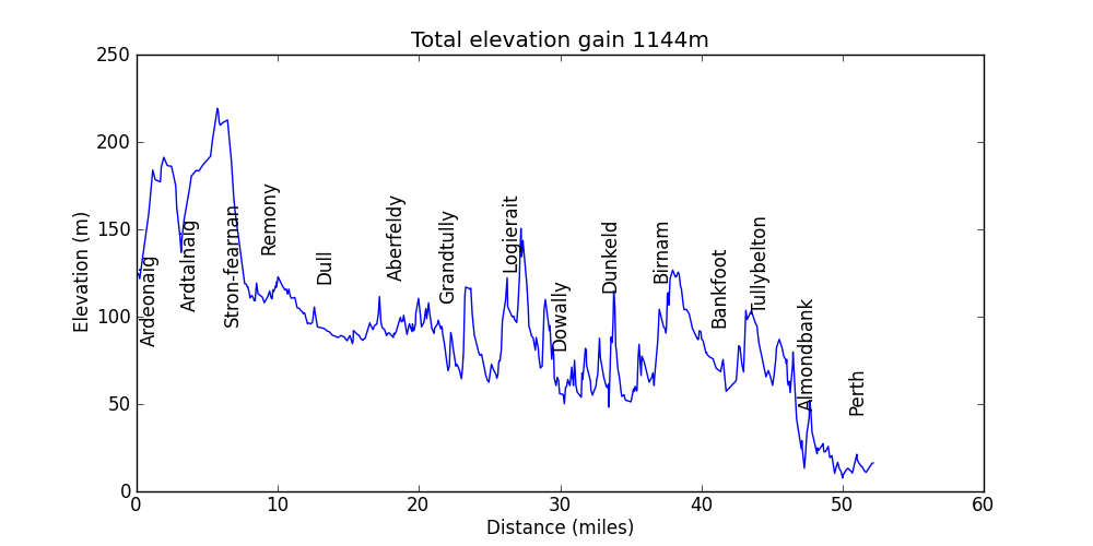
| Loch Tay to Perth | Profile | gpx file | kml file | 56 miles via NCR 7 and NCR 77 | |
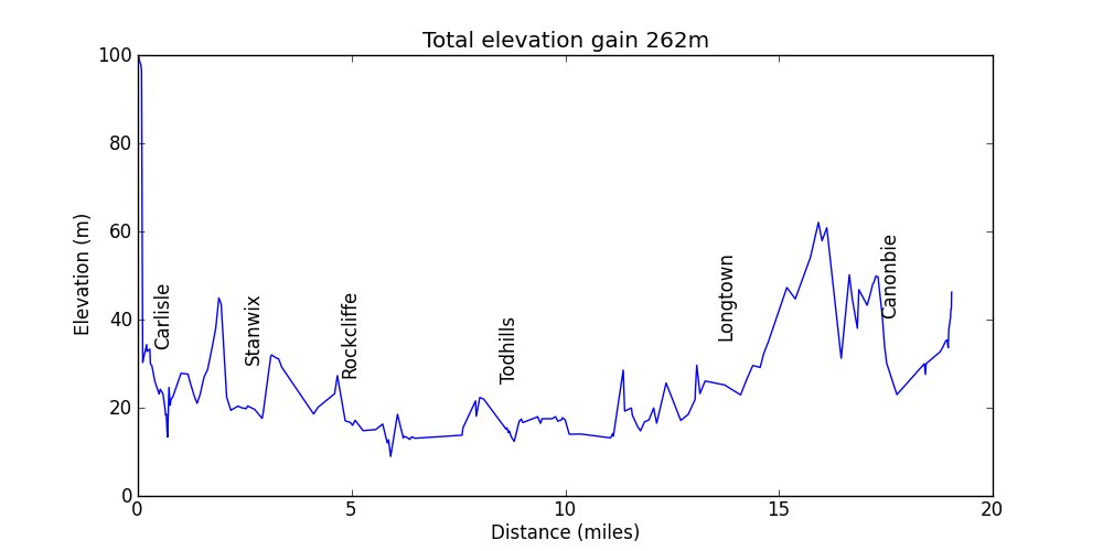
| Carlisle to Edinburgh part 1 | Profile | gpx file | 20 miles (warning - this route uses a dangerous bridge over the river near the border - find an alternative!) | ||
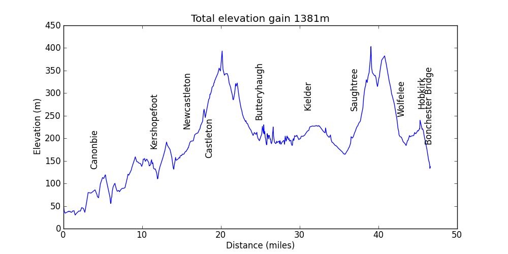
| Carlisle to Edinburgh part 2 | Profile | gpx file | 50 miles via Kielder Forest | ||
| Carlisle to Edinburgh part 3 | Profile | gpx file | 60 miles mostly on NCR 1 | ||
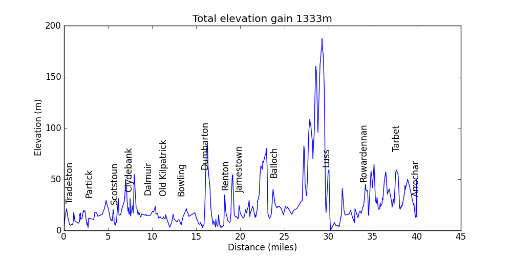
| Glasgow to Stirling part 1 | Profile | gpx file | 40 miles from central Glasgow up Loch Lomond to Loch Long; all traffic free but otherwise not the most interesting route; section along Loch Lomond runs alongside a very busy road for 15 miles | ||
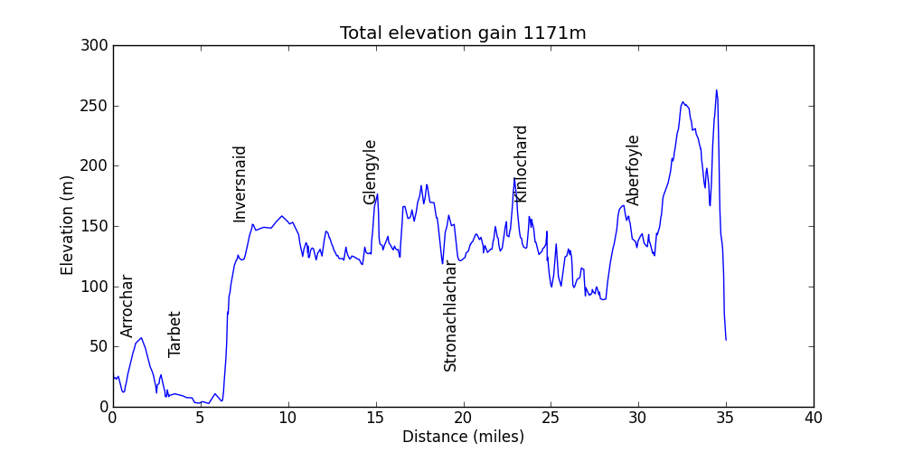
| Glasgow to Stirling part 2 | Profile | gpx file | 35 miles over Loch Lomond (on the ferry obviously); almost traffic free north shore of Loch Katrine; through Queen Elizabeth Forest Park to Aberfoyle | ||
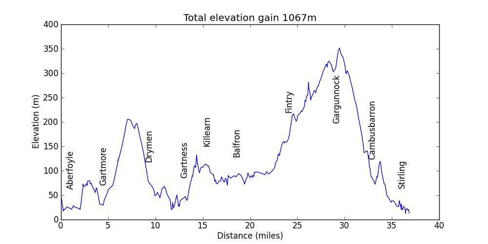
| Glasgow to Stirling part 3 | Profile | gpx file | 40 miles starting along NCR 7; through rolling hills; finishing with a climb and a descent with great views towards Edinburgh | ||
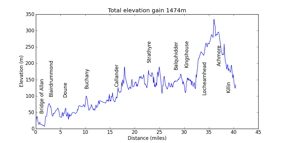
| Dunblane to Loch Tay and Loch Rannoch (loop) part 1 | Profile | gpx file | 40 miles from Bridge of Allan to Killin mostly traffic free on NCR 7 | ||
| Dunblane to Loch Tay and Loch Rannoch (loop) part 2 | Profile | gpx file | 55 miles from Killin to Kenmore via Glen Lyon and Loch Rannoch | ||
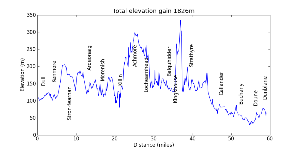
| Dunblane to Loch Tay and Loch Rannoch (loop) part 3 | Profile | gpx file | 60 miles from Kenmore to Dunblane | ||
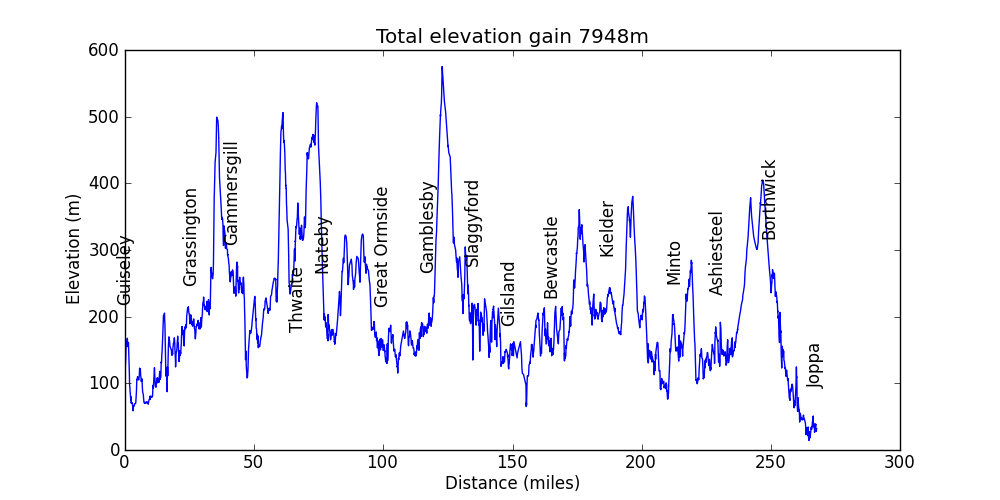
| Guiseley to Edinburgh | Profile | gpx file | 276 miles; Yorkshire Dales; Cumbria; Borders | ||
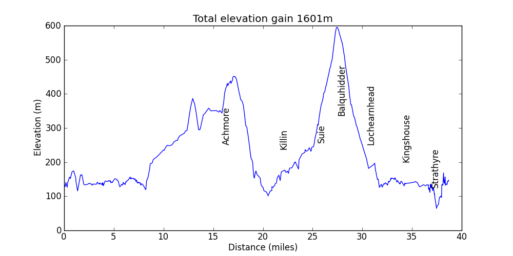
| Strathyre - Killin loop | Profile | gpx file | significant amount of very rough track (i.e. walking) up Glean Dubh but descent down Glen Kendrum is all cyclable; two easy fords; section on A84 is best avoided | ||
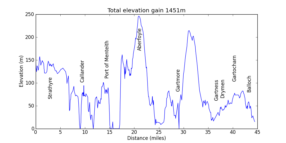
| Strathyre to Balloch (Loch Lomond) | Profile | gpx file | via Aberfoyle on NCR 7 | ||
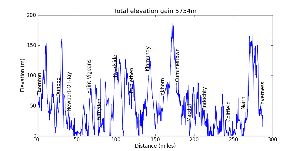
| Glenrothes to Inverness | Profile | gpx file | kml file | 298 miles on NCR 1 | |
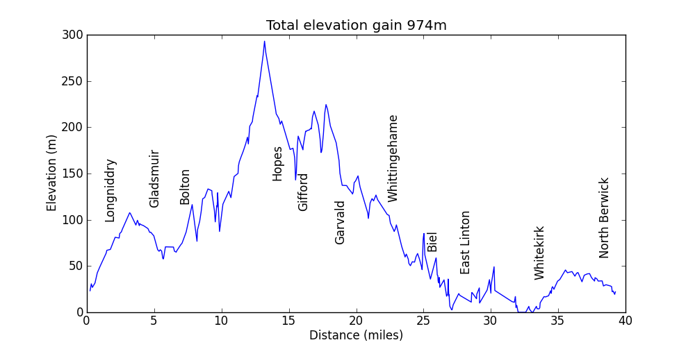
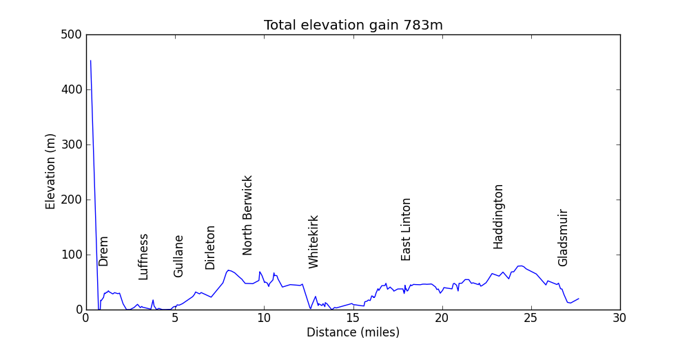
| East Lothian meander | Profile | gpx file | kml file | Longniddry; Gifford; Garvald; Tyninghame; North Berwick; 40 miles | |
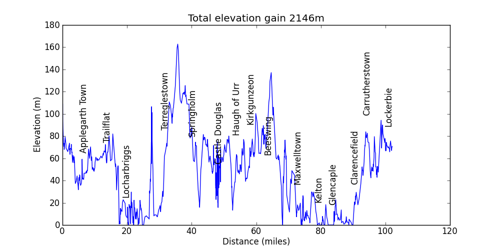
| Lockerbie - Dumfries - Castle Douglas | Profile | gpx file | Lockerbie to Dumfries 30 miles; Dumfries to Castle Douglas and back 40 miles; Dumfries to Lockerbie via coast 30 miles | ||
| Drem - Longniddry loop | Profile | gpx file | loop around East Lothian from Drem station to Longniddry station | ||
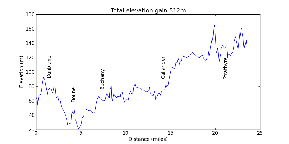
| Dunblane to Strathyre | Profile | gpx file | via Doune | ||
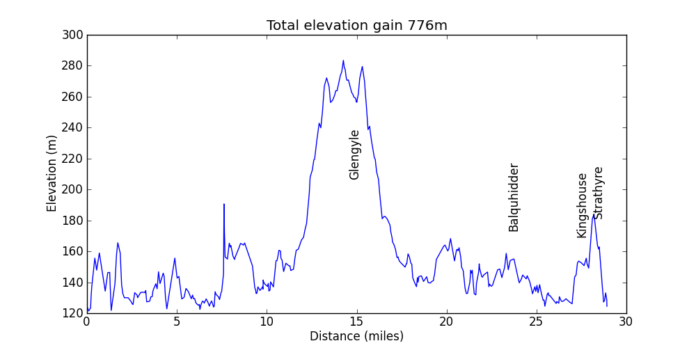
| Strathyre - Lock Voil there-and-back | Profile | gpx file | as far west as you can go on the track | ||
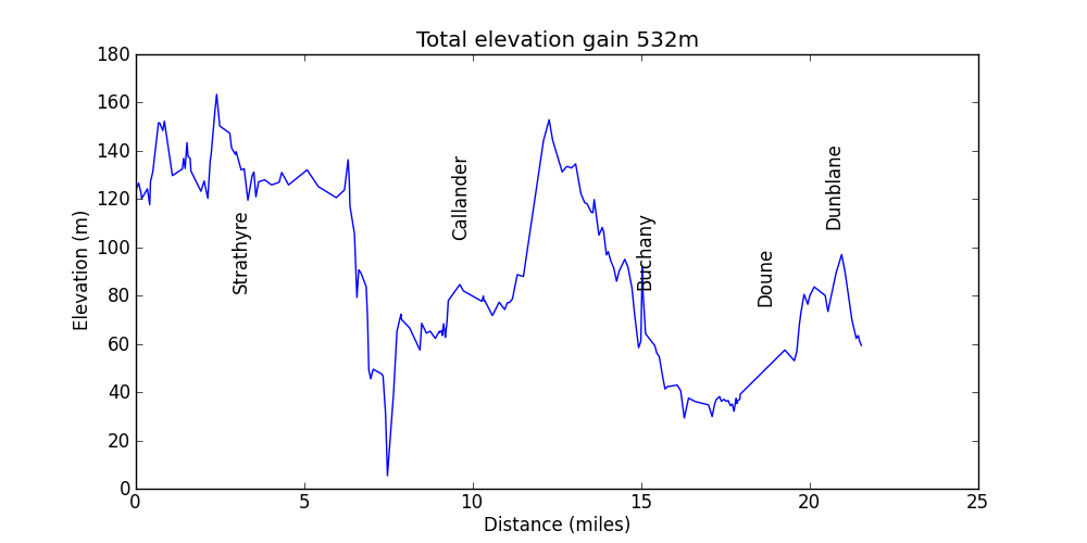
| Strathyre to Dunblane | Profile | gpx file | using a good railway path from Doune towards Dunblane (although involves a mile or so on the pavement beside the insanely busy A84) | ||
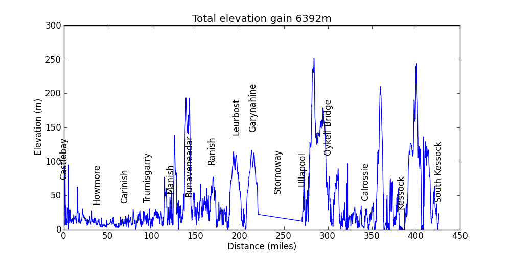
| Western Isles and Ullapool to Inverness | Profile | gpx file | 395 miles; Barra to Lewis; Ullapool to Inverness via the Black Isle | ||
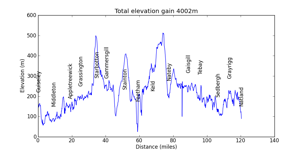
| Guiseley to Oxenholme | Profile | gpx file | 120 miles; Guiseley; Wharfedale; Coverdale; Wensleydale; Swaledale; Cumbria | ||
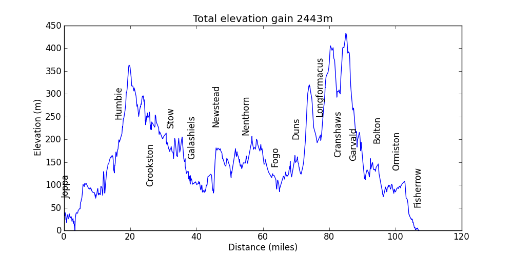
| Edinburgh - Galashiels loop | Profile | gpx file | 113 miles (41 out on direct route; 72 back over the Lammermuirs) | ||
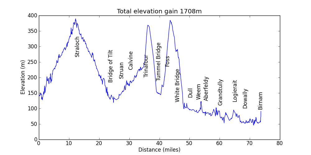
| Glen Tilt | Profile | gpx file | 74 miles; Blair Atholl; up Glen Tilt and back; Glen Erochty; Tummel Bridge; Aberfeldy; Dunkeld | ||
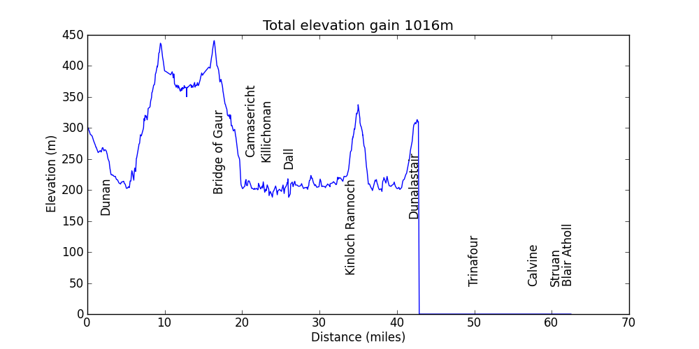
| Rannoch camping | Profile | gpx file | ?? miles; Rannoch Station; Loch Ericht; Loch Rannoch; Loch Conn; Blair Atholl | ||
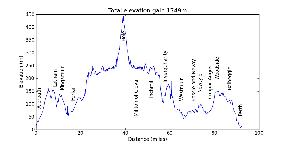
| Glen Doll | Profile | gpx file | 95 miles; Abroath; Glen Clova; Glen Doll; Perth | ||
| Dunbar - Drem | Profile | gpx file | 25 miles; Dunbar to Drem meandering | ||
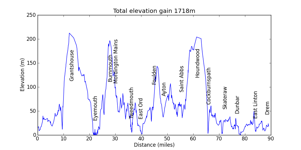
| Dunbar - Berwick-upon-Tweed - Drem | Profile | gpx file | 90 miles on the coastal route mostly using NCR 76 | ||
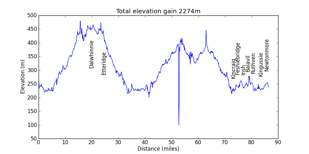
| Glen Tromie and Glen Feshie | Profile | gpx file | 90 miles largely on Landrover tracks | ||
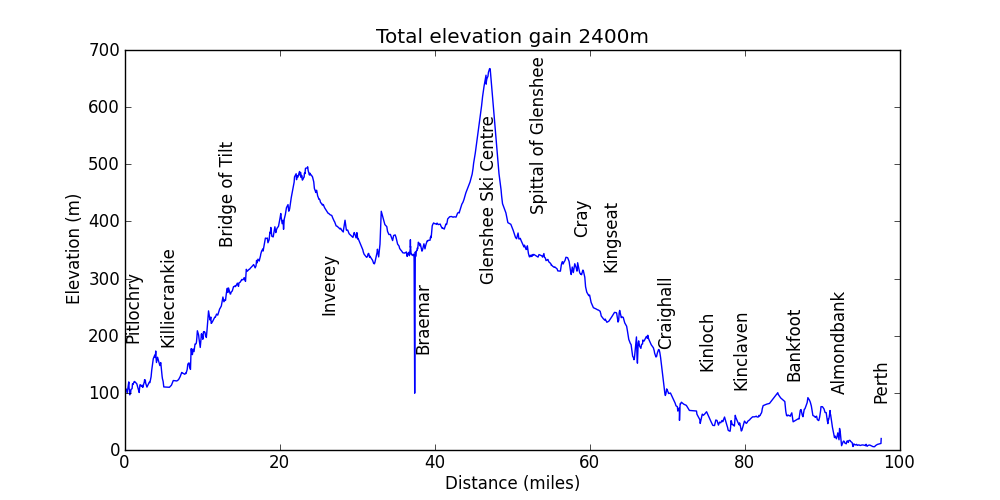
| Blair Atholl via Glen Tilt to Braemar then Perth | Profile | gpx file | 101 miles including 30+ on Landrover tracks and single track with a few miles on foot | ||